
|
www.WashOGS.org Geography & MapsGeographical Information | Township Maps Map Links |
|
|
www.WashOGS.org Geography & MapsGeographical Information | Township Maps Map Links |
Washington County Geographical Information
Page Top
Washington County, OH, lies in Appalachian southeastern Ohio along the Ohio River. It was the first county in the Northwest Territory in 1788 and at that time stretched from the Ohio River in the south to Lake Erie in the north. The county seat is Marietta, where the Muskingum River flows into the Ohio. The county's other city is Belpre. The current 22 townships are Adams, Aurelius, Barlow, Belpre, Decatur, Dunham, Fairfield, Fearing, Grandview, Independence, Lawrence, Liberty, Ludlow, Marietta, Muskingum, Newport, Palmer, Salem, Warren, Waterford, Watertown, and Wesley. Former townships include, among others, Harmar, Middletown, Jolly, Newton, Plainfield, Roxbury, Tuskarora, Union, and Wooster.
Washington County, OH, is bordered on the west by Athens County, on the northwest by Morgan County, on the north by Noble County, and on the northeast by Monroe County. Across the Ohio River it is bordered on the south mostly by Wood County, West Virginia, and slightly by Pleasants County, West Virginia, to the east.
The Ohio, Muskingum, and Little Hocking Rivers, forests, coal mines, farming bottoms, hilly livestock grazing areas, and petroleum have supported many of Washington County's occupations.
Non-native settlers included Yankee merchants and craftsmen from New England who were the first settlers in Marietta. There were also English farmers in Aurelius Township, German farmers in Fearing and Salem Townships and laborers in Marietta; Scottish sheep farmers in Barlow and Warren Townships, Irish farmers in Ludlow Township and railroad workers in Marietta; Jewish merchants and professionals in Marietta, African-American farmers and laborers in Decatur, Fairfield, and Wesley Townships; and Belgian glass workers in Marietta have all contributed to the economy of Washington County, Ohio.
The county census was 61,788 in 2010 and it is 640 square miles in size. See more data about the county at Data USA: https://datausa.io/profile/geo/washington-county-oh
Maps of Ohio and Washington County, Ohio
Page Top
MapGeeks.org: Interactive Historical Ohio County Boundaries Scroll down page
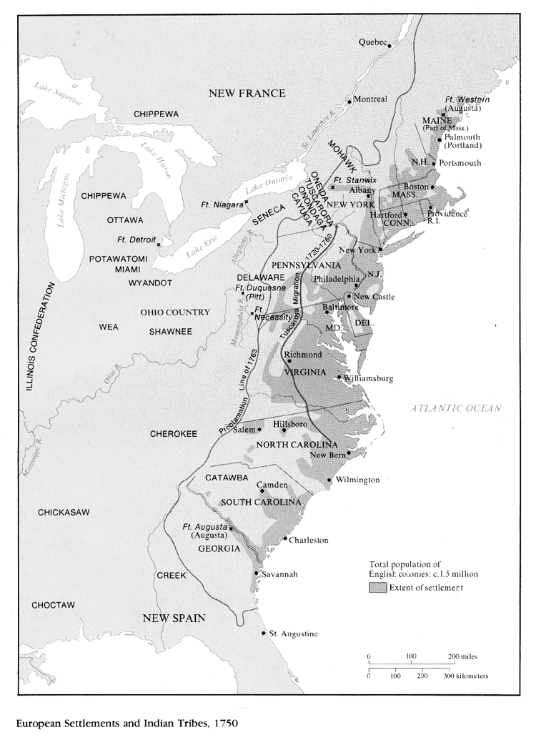
Maryland State Archives: 1750 map showing European settlements and Indian tribes
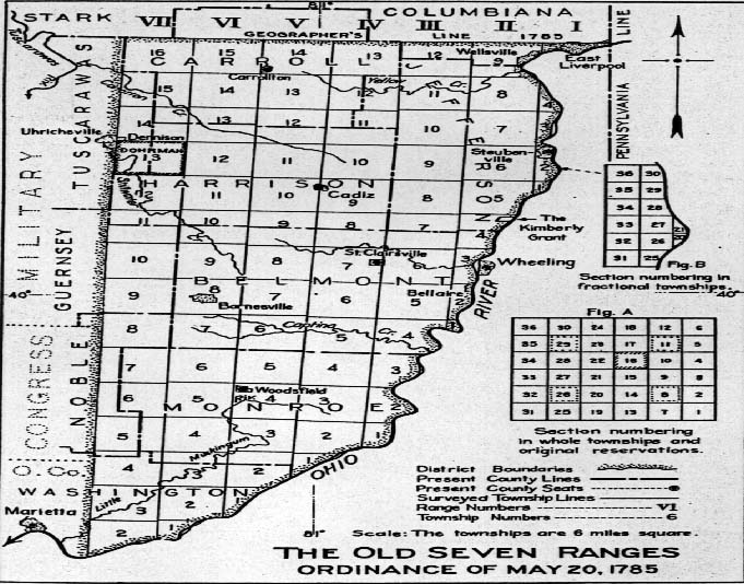
WSGW Archives.net: 1785 MapThe Old Seven Ranges
Wikipedia Commons: 1789 map of Northwest Territory and North America
Roots Web: Ohio Tracts & PurchasesMap Of Us.org: 1804 Ohio Atlas Map
Map Of Us.org: 1814 Ohio Atlas Map
Map Of Us.org: 1822 Map of Ohio from LeSage's Atlas
Map Of Us.org: 1836 Map of Ohio from New Universal Atlas
Map Of Us.org: 1845 Ohio Atlas Map
Library of Congress.gov: 1858 Lorey map of Washington County, Ohio
Map Of Us.org: 1866 Ohio Atlas Map
Library of Congress.gov: 1871 Map of the Marietta and Pittsburgh Railroad
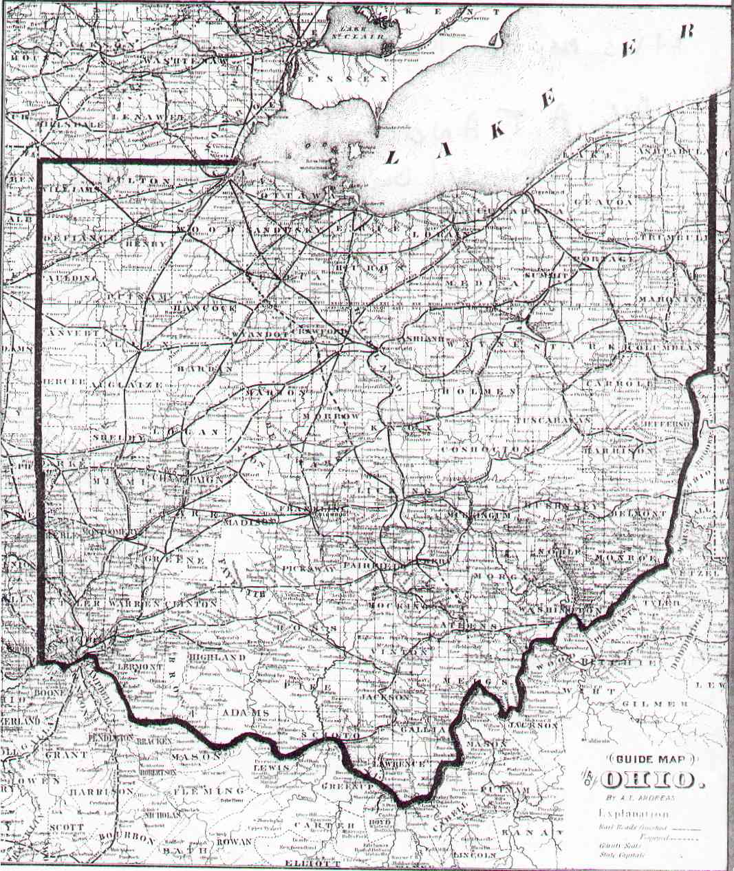
USGW Archives.net: 1873 Guide Map to Ohio
Ohio Company Survey Maps Items 01_0001 to 01_0204 (includes many owners's names - Circa 1800-1810) Marietta College Special Collection Digital Resources
Ohio Company Survey of Marietta & Harmar Map Link Tab 16, Item 01_0157
Ohio History.org: 1785 Lake's Atlas Map of Washington County
Ohio History.org: Index to the 1785 map (PDF document)
Internet Archive:
Ohio Archealogical Atlas 1914, William C. Mills, Ohio State Archeaolgical and Historical Society
David Rumsey.com: 1877 map of Marietta and Harmar, Ohio (may require turning off popup blocker)
David Rumsey.com: 1877 maps of Ohio River and Ohio River towns
Oplin: 1895 Sanborn Fire Insurance Maps from Ohio (You will need a current Ohio library card number (OPLIN)
Library of Congress: Beverly1895 Sanborn Fire Insurance Map (Library of Congress)
David Rumsey.com: 1928 Marietta Chamber of Commerce Map
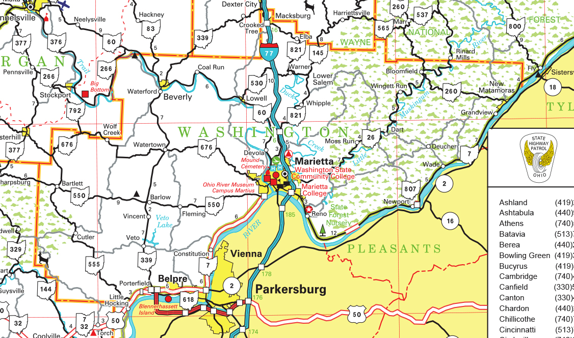
ODOT: Current Road Map of Washington County, Ohio (ODOT)
Washington County Auditor's Map
Ohio DNR.gov: Current Ohio Mines (ODNR)
The above links are provided as a public service.
Each Web site is responsible for its own content.